LA PRAIRIE, QUEBEC--(Marketwired - May 11, 2017) - The management of Vanstar Mining Resources Inc (TSX VENTURE:VSR)(FRANKFURT:1V8) announces that hole NE-17-56 from recently completed drilling program by IAMGOLD Corporation on the Nelligan Project has intersected visible gold at 475.75 metres depth. This drill hole tested the lateral continuity of drill hole NE-16-36, which previously intersected a gold structure grading 3.20 g/t Au over 17.97 metres, including 6.78 g/t Au over 4.2 metres.
The last winter drilling program included 17 drill holes for a total of 7,669 metres. It has verified the lateral and down depth extensions of different gold zones intersected during the previous drilling campaign and has also tested different IP anomalies (Induced Polarization).
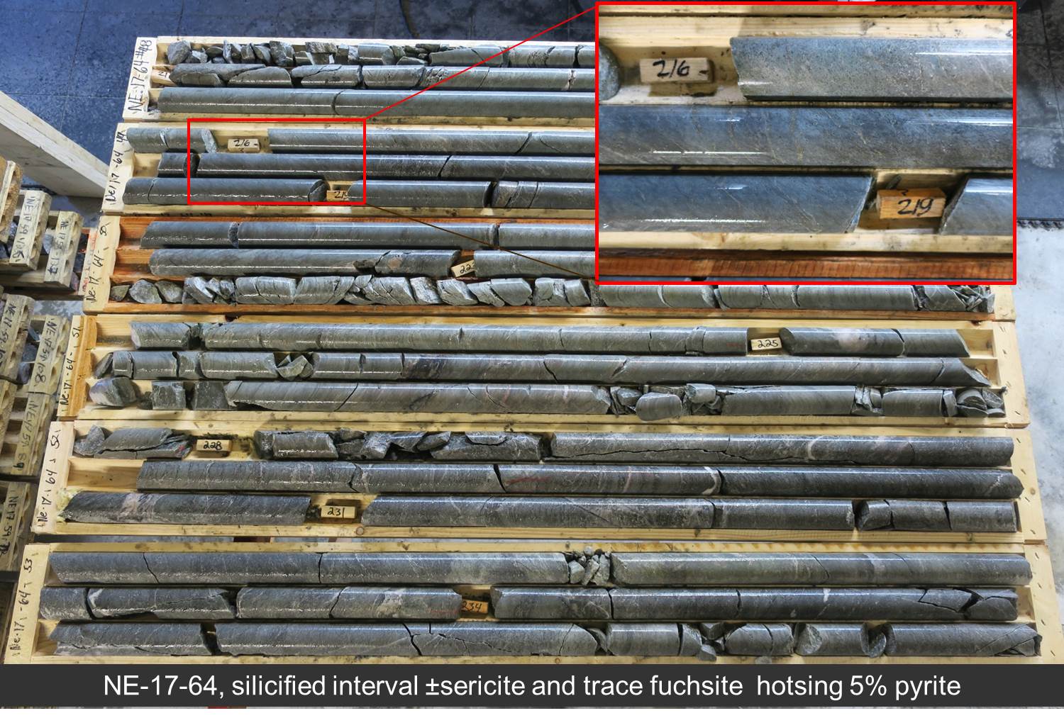
It is also noted that drill holes NE-17-61 and NE-17-64 located 1.5 and 0.9 kilometres west of drill hole NE-16-48 ( North gold corridor ), intersected similar zones of sulphide mineralization and alteration to the targeted structures of the North sector.
Drill hole NE-17-61 was testing a strong chargeability anomaly coinciding with an interpreted shear zone that could extend from NE-16-37 to the west. The beginning of the hole cut mineralized quartz-sericite schist followed by a mudrock where the amount of very fine pyrite increases to up 7% at the end of this interval. Silicified and brecciated zone contains very fine disseminated and clusters of pyrite up to 5 %. Pyrite occurred all along the hole.
While drill hole NE-17-64 was testing the extension of the interpreted shear zone that could extend from NE-16-37 to the west towards hole NE-17-61. The hole exposed right from the start well mineralized mudrock and wacke units, with 2-3% pyrite, and up to 10% pyrite from 205.9 to 234m in a silicified and sericitized interval. It ended in schistose wacke and mudrocks.
NE-17-64 Drill Core image: http://media3.marketwire.com/docs/Vanstar_1094385.jpg
All of the program's objectives were met and Vanstar is awaiting assay results. This press release was read and approved by Mr. Gilles Laverdière, qualified geologist under National Instrument 43-101.
Miron Project
Vanstar also announces the acquisition by map designation of 4 additional cells that will be included in the Miron Project that now includes 14 cells covering an area of 784 hectares. This project is located on the west border of the Nelligan project, which is part of an option agreement with IAMGOLD Corporation.
The project is located on the contact of a volcanic sedimentary environment that contains conglomerates and iron formations. The Miron project also contains many local and regional faults as well as low mag anomalies. No IP surveys were done on this project.
Vanstar management is considering different scenarios for the development of the Miron and Emile projects, located on both sides of Nelligan.
Location Map: http://media3.marketwire.com/docs/Miron_Emile_location_map.pdf
Neither TSX Venture Exchange nor its Regulation Services Provider (as that term is defined in the policies of the TSX Venture Exchange) accepts responsibility for the adequacy or accuracy of this release.
Contact Information:
Guy Morissette
CEO
819-763-5096
gmvanstar@vanstarmining.com